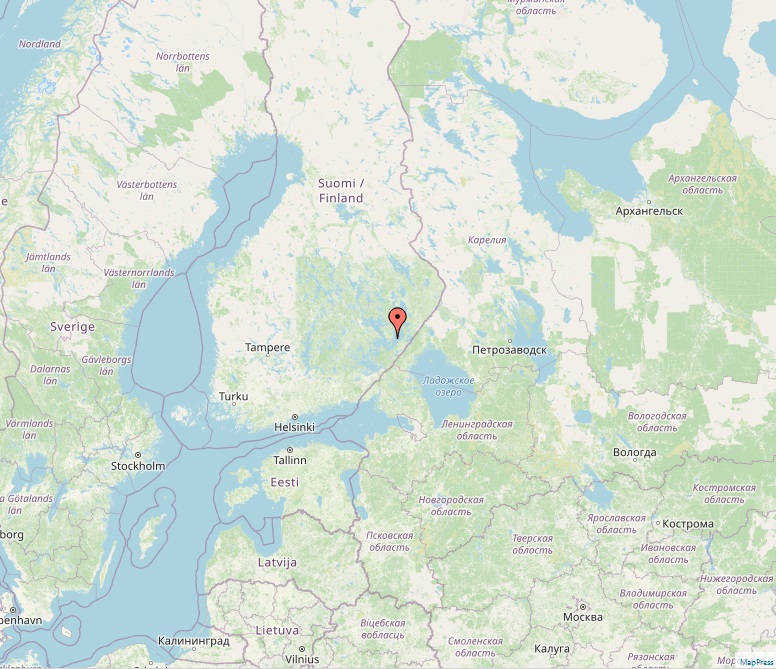
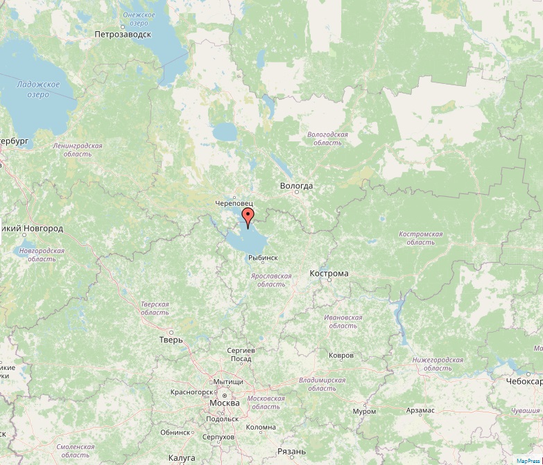
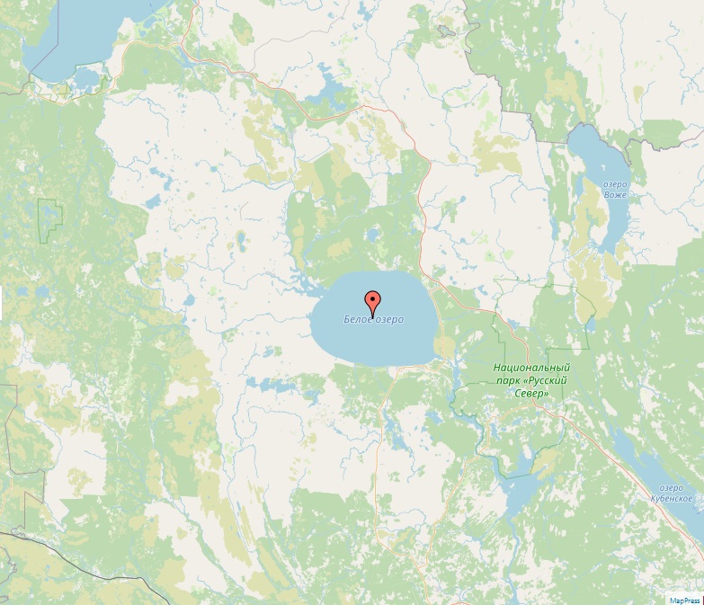
Lake Beloye

Lake Beloye

Lakes
Lake Beloye, also known as White Lake, is a significant natural water body located in the northwestern part of Vologda Oblast, Russia. As the second-largest natural lake in Vologda Oblast, after Lake Onega, and the third largest when including the Rybinsk Reservoir, Lake Beloye stands as one of the ten biggest natural lakes in Europe. Geographic and Hydrological Characteristics The lake spans an area of 1,130 square kilometers, with a diameter of about 46 kilometers, and it has a maximum width of 33 kilometers. The lake's basin, which extends over 14,000 square kilometers, encompasses parts of Belozersky, Vashkinsky, Babayevsky, and Vytegorsky Districts in Vologda Oblast, and some areas in Kargopolsky District of Arkhangelsk Oblast. This basin is rich in smaller glacial lakes, contributing to the region's diverse aquatic ecosystem. Primary…
Read More
Gorky Reservoir

Gorky Reservoir

Lakes
Lake Gorky Reservoir, also known as Gorky Sea, is a prominent artificial lake formed on the central part of the Volga River in Russia. This significant hydroelectric reservoir was created by the Gorky Hydroelectric Station, now called the Nizhny Novgorod Hydroelectric Station, which was constructed between the towns of Gorodets and Zavolzhye between 1955 and 1957. Geographical and Hydrological Features Spanning an impressive length of 430 kilometers from the dam of Rybinsk to the dam of Gorodets, the reservoir traverses through the Yaroslavl, Kostroma, Ivanovo, and Nizhny Novgorod oblasts of Russia. While the upper part of the reservoir closely follows the natural riverbed of the Volga and is relatively narrow, it expands to a width of up to 16 kilometers downstream near the town of Yuryevets. The maximum depth of…
Read More
Saratov Reservoir

Saratov Reservoir

Lakes
The Saratov Reservoir, an expansive artificial lake located in the lower part of the Volga River in Russia, represents a significant achievement in hydroelectric engineering. Formed by the dam of the Saratov Hydroelectric Station in the city of Balakovo, the reservoir has been a vital component of the region's infrastructure since its inception in 1967. Geographical Spread and Characteristics Stretching over a length of 357 kilometers and reaching a width of up to 25 kilometers, the Saratov Reservoir covers a surface area of 1,831 square kilometers. With an average depth of 7 meters, it spans across the territories of Samara Oblast and Saratov Oblast, encompassing a diverse range of landscapes and ecological zones. Strategic Importance The reservoir's strategic location impacts several key cities. The uppermost point of the reservoir is…
Read More
Lake Vättern

Lake Vättern

Lakes
Lake Vättern, the second largest lake in Sweden and the sixth largest in Europe, is a remarkable fresh water body located in south-central Sweden. It is distinguished by its long, finger-shaped structure and its significant depth, reaching 128 meters at its deepest point. Despite being approximately one-third the surface area of Lake Vänern, Sweden's largest lake, Vättern contains nearly half its water volume, demonstrating its profound depth. Geographic and Hydrological Aspects Spanning an area of about 1,912 square kilometers, Lake Vättern has a drainage basin of approximately 4,503 square kilometers. Its catchment area is more than double its surface area, indicating the extensive network of rivers and small lakes that contribute to its water volume. The lake is drained by Motala ström and has a surface elevation of 88 meters.…
Read More
Kakhovka Reservoir

Kakhovka Reservoir

Lakes
The Kakhovka Reservoir, situated on the Dnieper River in Ukraine, represents a significant hydrological structure in the region. Created in 1956 following the construction of the Kakhovka Dam at Nova Kakhovka, it has been a key component in the Dnieper reservoir cascade, playing a crucial role in the area's water management, irrigation, and power generation. Geographical Expanse and Uses The reservoir extends across the territories of Kherson, Zaporizhzhia, and Dnipropetrovsk Oblasts in Ukraine. It spans an impressive length of 240 kilometers and reaches a width of up to 23 kilometers. The reservoir's average depth is 8.4 meters, with its deepest point at 26 meters, and holds a total water volume of 18.2 cubic kilometers. The creation of the Kakhovka dam elevated the natural water level of the Dnieper River by…
Read More
Kremenchuk Reservoir

Kremenchuk Reservoir

Lakes
Lake Kremenchuk Reservoir, prominently located on the Dnieper River, stands as the largest water reservoir in Ukraine. Encompassing the territories of Poltava, Cherkasy, and Kirovohrad Oblasts in central Ukraine, it is a significant hydrological feature in the region, named after the nearby city of Kremenchuk. Key Features and Usage Spanning an expansive area of 2,250 square kilometers, the reservoir extends 149 kilometers in length and 28 kilometers in width, with an average depth of six meters. It holds a substantial water volume of 13.5 cubic kilometers. The primary uses of Lake Kremenchuk Reservoir include irrigation, flood control, fishing, and as a vital transportation route within the area. Its strategic location has led to the development of main ports such as Cherkasy and Svitlovodsk (formerly known as Khrushchev) along its banks.…
Read More
Tsimlyansk Reservoir

Tsimlyansk Reservoir

Lakes
The Tsimlyansk Reservoir, also known as Tsimlyanskoye Reservoir, is an expansive artificial lake situated on the Don River, straddling the territories of Rostov and Volgograd Oblasts in Russia. Established in 1952, it is recognized as one of the largest reservoirs in the country, playing a pivotal role in regional development. Key Features and Functions The reservoir's creation has been integral to the agricultural, industrial, and navigational development in the Rostov and Volgograd regions. It serves multiple purposes, including power generation through the Tsimlyansk Hydroelectric Station, and providing vital irrigation for a variety of crops such as wheat, rice, cotton, maize, alfalfa, fruit, grapes, and vegetables. Navigational Importance One of the key roles of the Tsimlyansk Reservoir is its contribution to navigation. It forms a crucial segment of the waterway connecting…
Read More
Lake Peipus

Lake Peipus

Lakes
Lake Peipus, known as Peipsi-Pihkva järv in Estonian and Чудско-Псковское/Псковско-Чудское озеро in Russian, holds the distinction of being the largest trans-boundary lake in Europe, straddling the border between Estonia and Russia. Ranking as the fifth-largest lake in Europe, it presents a significant natural and cultural landmark in the region. Geographical and Hydrological Features Covering an area of 3,555 square kilometers, Lake Peipus is characterized by its relatively shallow waters, with an average depth of 7.1 meters and a maximum depth of 15.3 meters. The lake comprises three main parts: Lake Peipsi/Chudskoye, the northern section; Lake Pihkva/Pskovskoye, the southern part; and Lake Lämmi/Tyoploye, a connecting sound. The primary inflows to the lake are the Velikaya and Emajõgi rivers, and it drains into the Gulf of Finland via the Narva River. Historical…
Read More
Lake Saimaa

Lake Saimaa

Lakes
Lake Saimaa, nestled in the Finnish Lakeland region in southeastern Finland, stands as the country's largest lake and ranks as the fourth-largest natural freshwater lake in Europe. Spanning approximately 4,279 square kilometers, this expansive body of water is a central feature of the region's landscape and a significant natural resource. Historical and Geological Background Formed through the melting of glaciers at the end of the Ice Age, Lake Saimaa has a rich geological and historical background. Its development over thousands of years has significantly shaped the surrounding landscape and ecosystems. The lake's name is thought to originate from a non-Uralic, non-Indo European substrate language, indicating its long-standing significance in the region. Geographical Characteristics The lake's topography is unique, characterized by a complex system of islands and narrow canals that divide…
Read More
Rybinsk Reservoir

Rybinsk Reservoir

Lakes
The Rybinsk Reservoir, often referred to as the Rybinsk Sea, is a significant hydroelectric reservoir located in Russia, spanning the regions of Tver, Vologda, and Yaroslavl Oblasts. Formed by the dam of the Rybinsk Hydroelectric Station on the Volga River and its tributaries, Sheksna and Mologa, it stands as a monumental example of human engineering and its impact on the natural and social environment. Construction and Historical Significance The construction of the Rybinsk Reservoir began in 1935, marking a significant phase in Soviet hydraulic engineering. The reservoir began filling on April 14, 1941, and reached its full capacity by 1947. At the time of its completion, it was recognized as the largest man-made body of water on Earth. This massive project necessitated the resettlement of about 150,000 people as the…
Read More